Saturday April 6, 2019
Road video and map – Bullhead City to Tusayan, AZ
Much of today was spent driving historic Route 66 as I made my way to the south rim of the Grand Canyon. My original plan was to spend two days to get from Laughlin to Grand Canyon so that I could drive Route 66 at a leisurely pace, stop in Williams overnight (which is about 50 miles from Grand Canyon) and then arrive at the canyon early the next day. Unfortunately my lost day due to the flight issues, and having an expensive, non-refundable hotel reservation at the Grand Canyon for Saturday, meant that I needed to do it in one day. I checked out of my Laughlin hotel early, crossed into Arizona and had a great breakfast at the Black Bear Diner in Bullhead City which is where today’s video begins.
I had expected the small communities along Route 66 to have lots of interesting historic buildings but, in this part of Arizona, that was not the case. There are, basically, just four potential stops:
- Oatman, a tiny wild west town which seems authentic, has wild animals wandering around and daily gunfights in the streets. Interesting but I didn’t stop because I had already visited and little was happening when I passed through at 8:35 AM. You can see it well in the video.
- Kingman, a good sized, modern town but little historic preservation. I only stopped for gas.
- Peach Springs, a tiny place on the Hualapai reservation with two historic buildings. Just a quick photo stop as the cultural center and museum was closed.
- Seligman, a historic town with quite a few original Route 66 buildings but most of them filled with touristy gift shops. I stopped for half an hour to see the sights.
I was able to check in to my hotel early which allowed me to edit and begin uploading the road video before going to the south rim. Even though I’ve been here several times it is always impressive and there were far fewer visitors than in the summer. I used my time to ride the shuttle along the west rim and hiked the rim trail part of the way back enjoying the peace and taking a few photos along the way.
A section of Route 66 just outside Oatman.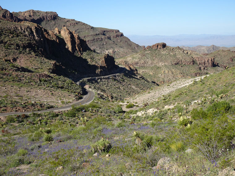
The only truly historic Route 66 relic I saw was this gas station at Peach Springs.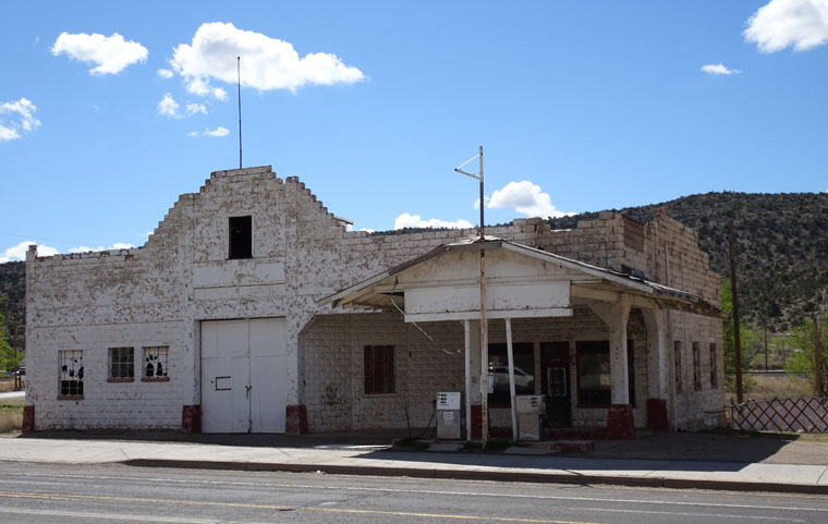
Route 66 in Seligman, AZ.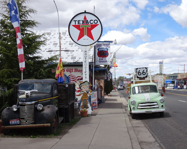
My very first view of the South Rim in 10 years. It was mainly cloudy but a few patches of sunlight provide some contrast.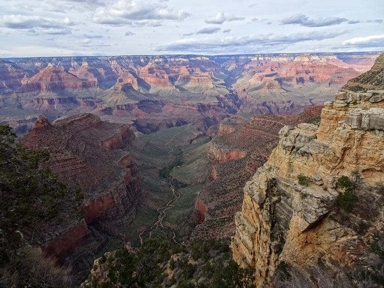
This area is called The Abyss as the sheer rock faces are 3,000 feet high between the rim and the first plateau.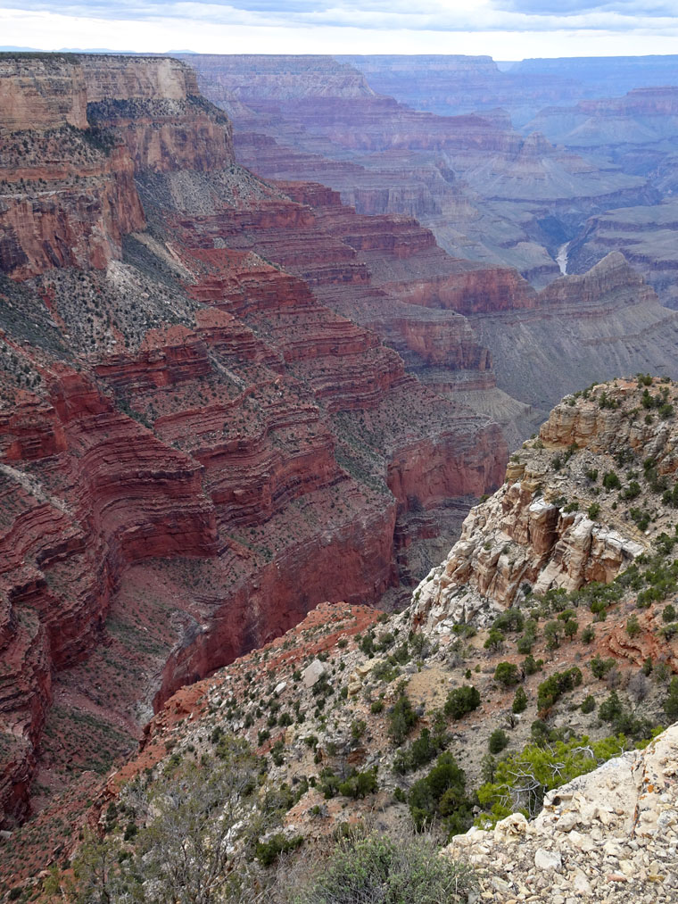
Further along the rim trail you get good views of the Colorado River but, by now, there was complete cloud cover and little contrast.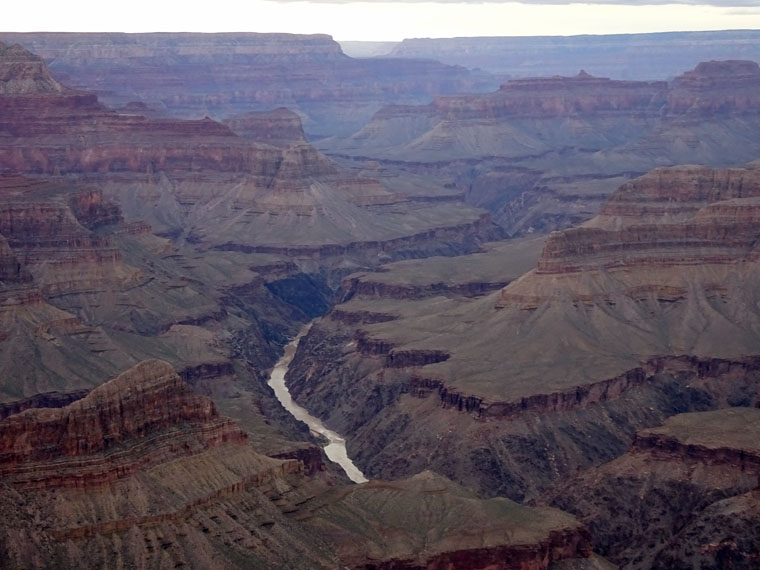
I left a little before sunset due to the clouds but the light rock at this part of the rim shows the rock layers well.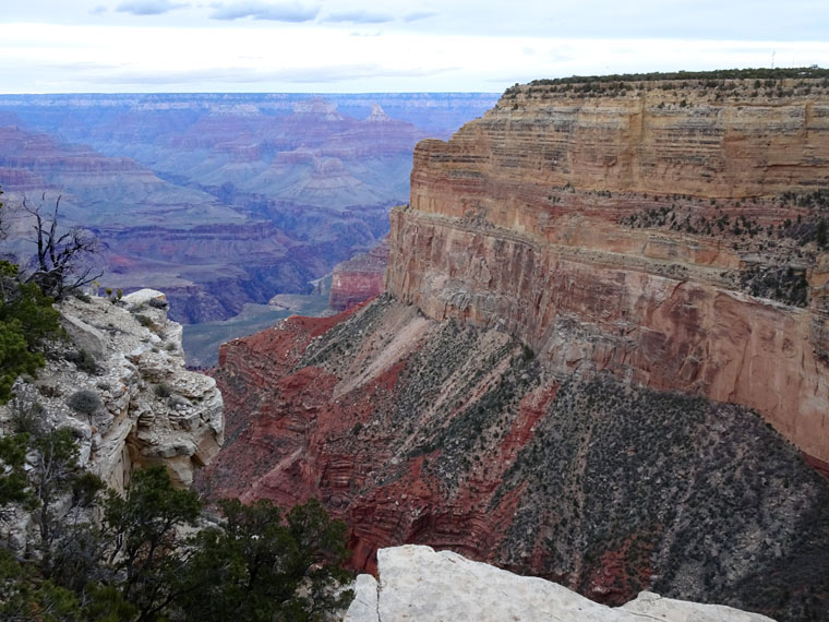
These pictures are amazing!! I didn’t know you hiked? Do you have special hiking outfits? If se I’d like a picture of that as well. Especially if it involves a hat!! I’m enjoying living vicariously!
Glad you like the pictures. I don’t hike in the Appalachian Trail sense but I am happy to walk a few miles to see stuff and I do have hiking boots, dark green rain gear and a backpack so it’s possible I might be mistaken for a hiker. No pictures of that Steve to post as the weather has been good.
Wowwww, transporting even from here, Steve. Wondrous to see.
The photos and stories can never substitute for being here but I’m glad you are enjoying the blog. Thanks for tagging along.
Unlike Eastern Canada, I am being reminded of places I visited on my 2008 tour (Vegas, Lake Mead, Hoover Dam, Oatman, Seligman). I shall try to resist posting “when I was there….”.
No need to resist, it’s always fun to hear other peoples reminiscences of places I’ve seen. Hope you are doing well.