No, I didn’t forget to post about day 37 (it was spent in Eureka getting my car serviced, doing laundry, accounting and other sundry tasks) but Day 38 (October 30) was wonderful and definitely worth posting!
Most people are aware of California State Route 1 which is the spectacular road that hugs the coast for 655 miles north of LA and features such well known sights as Big Sur and Carmel. Route 1, however, does not go all the way north to the Oregon border because the ruggedness of the coast in this section presents too many physical challenges. There are places where the land rises to over 4,000 feet within 3 miles of the ocean and cliffs up to 1,000 feet tower over the beaches. This area is called the “Lost Coast” but there is one narrow, very twisty, very scenic road that accesses the area and that road was the first half of today’s journey. The loop begins in the town of Ferndale and encompasses dark forests, high plains with sweeping views, steep hills, one lane bridges, the westernmost point in California and a couple of beautiful redwood groves before it ends in Humboldt Redwood State Park. The highlight, of course, is the short section of coast as it affords good views of Cape Mendocino and Sugarloaf Island just beyond the cape.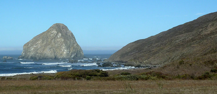 As I already mentioned, this is as far west as you can go (on a road) in California but it is also the most seismically active place in California. Just a few kilometers out from Sugarloaf Island is the Mendocino Triple Junction where the Pacific, North American and Gordo tectonic plates meet. This is the northern end of the San Andreas fault and an area where the other plates are sliding under the North American plate to create the cliffs and volcanoes of the region as well as the Sierra Nevada and Cascade mountain ranges. Since 1980 there have been at least ten strong earthquakes of magnitudes 6.5 or more and the latest, a 6.9, was just last year. Despite all that activity, the most numerous residents of the area, the cattle, seemed surprised by my presence when I stopped to take a photo..
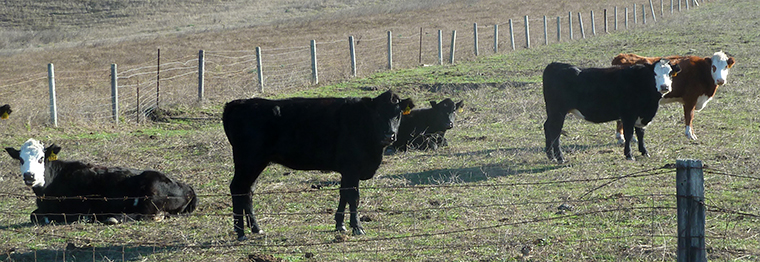 This was only the first half of a day that provided so much scenic pleasure that I had to create two videos. The Lost Coast part is here.
On reaching Humboldt Redwood State Park the Lost Coast road passes through two groves of redwood trees that were all the more impressive because the road was so narrow. This section is where the second part of the map/video begins and can be found here.
The size of these trees is difficult to convey but I took a short walk in a region where a number of trees had been downed by a severe storm in the 1980s and the photo below should illustrate their size.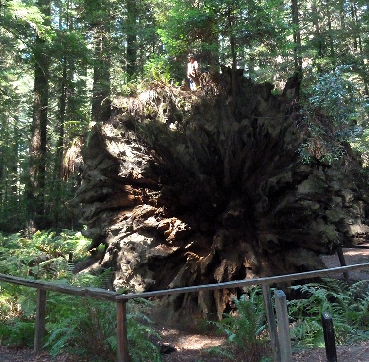 Did you notice the fully grown human male standing on top?
The focus of the park is the Avenue of the Giants which is the name given to the old highway that was the main road through the area until the 101 freeway was built. This is very similar to the scenic road through Redwood National Park. After leaving the park I drove a few miles south on the freeway to get to that northern end of California State Route 1. This initially winds through lush forest along a deep canyon with almost continuous curves and switchbacks before arriving at the coast and providing views like this.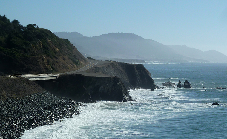 A few miles south of here I stopped at Fort Bragg for the night. For someone, like me, who enjoys driving and the sights that can be seen from the road there will be few days better than this.
Spent 14th August 2011 driving from Arcata to Fort Bragg which is perilously close to “great minds thinking alike”. Curiously my Eureka highlights seem to have been the zoo and the Borders closing-down sale. Did 101 not the Lost Coast. A migraine gradually developed all the way from Leggatt to Fort Bragg (mine are usually trivial and go away). So your recording brings back a mixed memory.