Today was the highlight of my trip so far as I drove and hiked in and around Glacier National Park. The most famous feature of the park is a road that traverses it in the east-west direction called “The Going to the Sun Road”. Glacier is the northern end of the US Rockies and, although the mountains (and probably the visitors) are not as high here as they are in Colorado, the mountains are more rugged and, in my opinion, more impressive. Unfortunately, there were two issues that affected the day.
The first was that, on Monday, the National Park Service closed the eastern third of the Going to the Sun Road (shown in green on the map below) so my plan of using it to drive across the park was a non-starter. However, this turned out to be a bonus because I had to use Route 2, which skirts the southern end of the park, to get to the western entrance at West Glacier and that turned out to be very scenic.
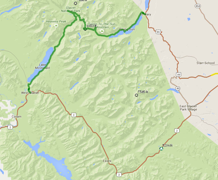
The scenery today, even from the dash cam, was so great that I could not accelerate the video too much. Therefore I have created three map/video pages. In each video the map sections in cyan are the highlights and are only accelerated by factor of five.The first, from Shelby to West Glacier, is here. I did not bother with any voice-overs as the views speak for themselves.
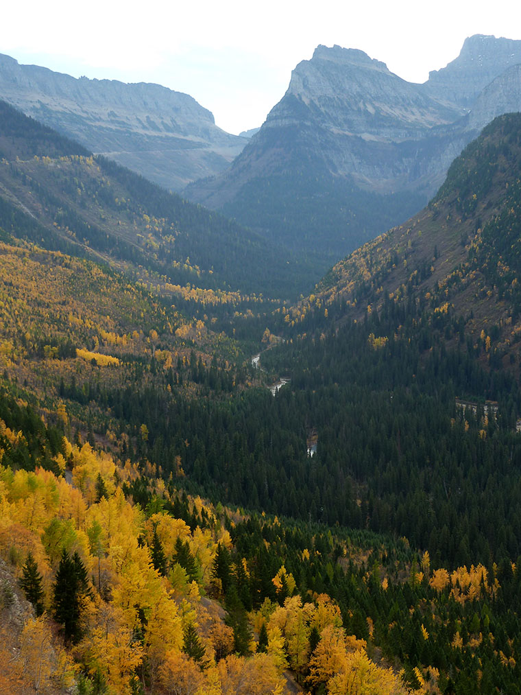
Once I got to the park entrance at West Glacier I was able to drive eastbound on the Going to the Sun Road as far as its highest point, Logan Pass (marked on the map as 6653 feet). This was a beautiful drive and I stopped frequently to take in the views and take photos.
This brings me to the second issue – haze. There were two major wildfires in the park this summer and one is still burning. This means that the air is not at all clear and deprived me of the spectacular photos that should be possible. With some extensive work in Photoshop it is possible to significantly reduce the effect of haze but that is a project for when I am home in the winter. Unfortunately, the video of this part of the drive is significantly affected by the haze as you can see here.
At Logan’s Pass I took a hike to Hidden Lake Overlook before retracing my route back along the Going to the Sun Road and driving to Kalispell, Montana. The map/video of that section is here and is less affected by haze.
I think that the videos are more impressive than the photos today and encourage you to watch at least one of them.
Lake McDonald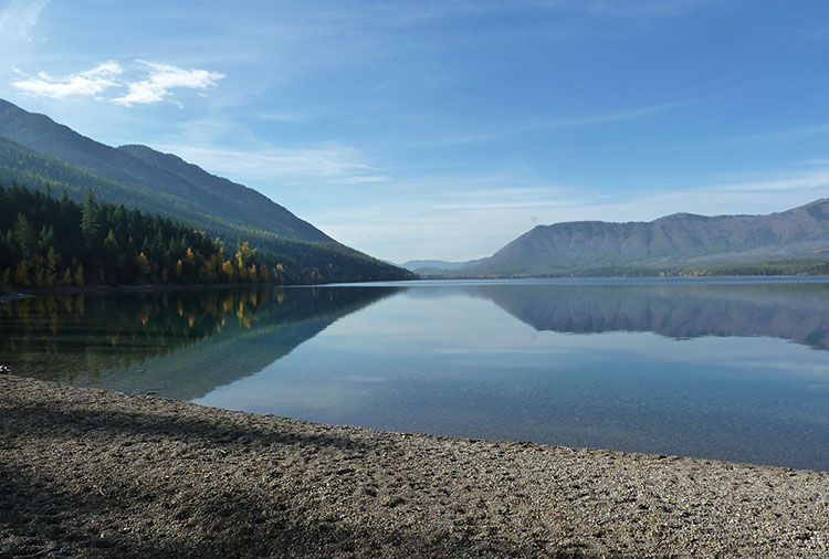 Two views from the Going to the Sun Road
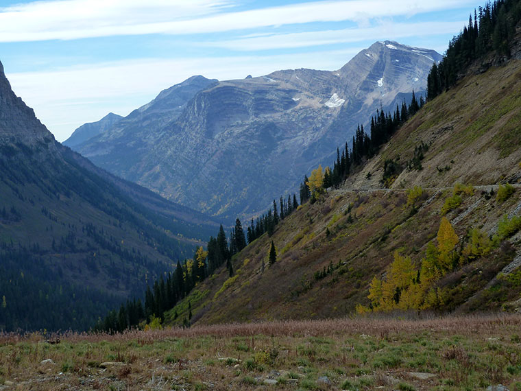
 View from Logan Pass
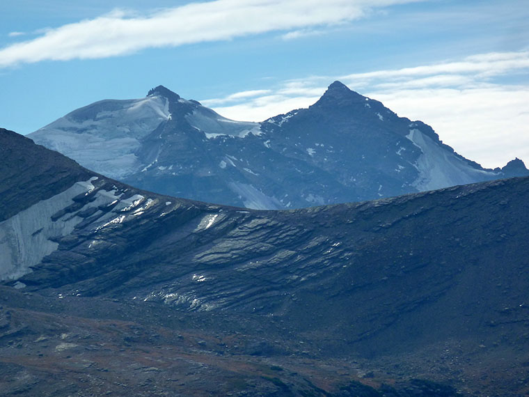 Hidden Lake
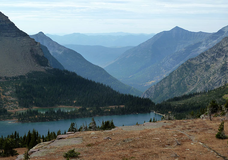
p,s. The post was delayed by a lousy Internet connection that took 11 hours to upload the videos to YouTube
I finally caught up with you! I’ve watched all the video footage up this point now.
Please can you clean that smudge off your windscreen. 🙂
That’s pretty impressive. Even I have not watched all the processed video – but I have seen it all live.
I will investigate the smudge. I usually remember to clean the windscreen each morning.
Your start and finish point almost exactly match Cut Bank to Kalispell I did in 2014. I had the advantage that the road was open but the disadvantage that the car park at the top was full. You’ll remember I’m not a patient queuer so I stopped at the car-park you briefly stopped in in both directions (Weeping Wall?).
As I said in the post, the closure ended up as an advantage. There were not many people around so parking was easy everywhere. For some reason most people seemed to be older, like me.
Hi Steve,
I have watched all your videos too! I am usually catching up on weekends (like now) and dramatically improving my knowledge of this part of the US thanks to you!
Stay safe!
Dominique
Thanks for following along. It’s nice to know that others find it interesting. Cheers, Steve/
Glad smudge is going! Remember this wonderful road and NP very well.. happy days, and beautiful autumnal colours