Thursday Oct 4, 2018
Map and road video – Charlottetown, PE to Hopewell Rocks, NB
Another day with significant driving but one that offered a huge reward at the end. I left Charlottetown in light rain and headed to Cavendish on the northern coast of Prince Edward Island. This is the most popular tourist destination in the province thanks to its appearance as the fictional Avonlea in the novel Anne of Green Gables. The farmhouse that once belonged to two of her cousins, and that was used as the setting for the novel, is preserved and there are many other Anne attractions that have been added in the small town. Today, however,most of the tourist traps were closed and I was able to enjoy Gulf Shore Parkway, part of Prince Edward Islands NP, almost alone. This short scenic drive follows the red cliffs that line the coast here and provides viewing points along the way. The cliffs are not at all impressive in size but the color of the rock is remarkable, even in cloudy conditions. I can only imagine how glorious it would be in full sunshine.
I then cut back south across the province to drive to New Brunswick over the 8 mile (13 km) long Confederation Bridge that connects the island to the mainland. Construction of the bridge was completed in 1997 and represented the complete fulfillment of a commitment, given in 1873 by the Dominion of Canada to Prince Edward Island when it joined the Confederation, to maintain a full time mail and passenger service with the mainland through all seasons. Unlike the ferry, the bridge was very boring with no views to be had.
My destination was Hopewell Rocks on the northern end of the Bay of Fundy where tide levels typically vary by about 52 feet (16 m) and the twice daily rush of water has carved amazing rock formations as it eats away at the rocky coastline. The interpretive center here had a good way of describing the power of the tides here by explaining that the volume of water that flows in and out of the bay every twelve hours is approximately equivalent to all the water flowing through the world’s rivers each day.
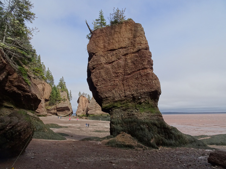
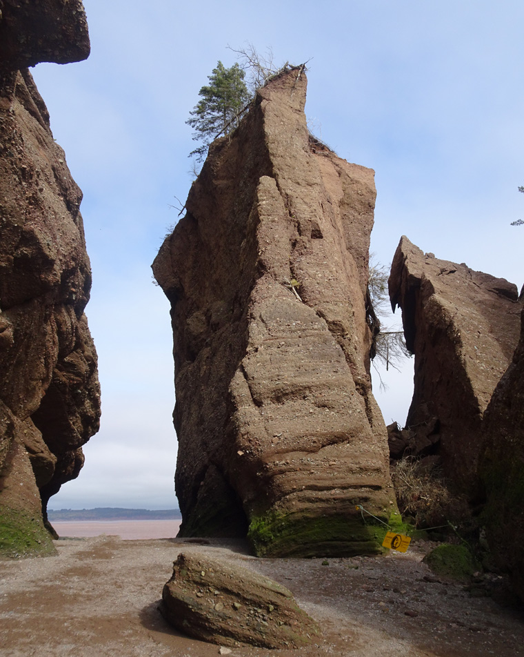
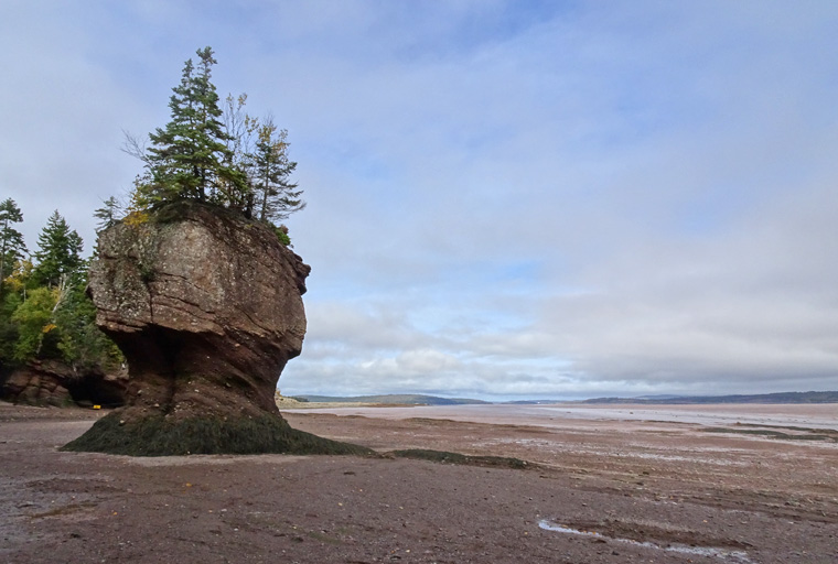
I arrived about two hours before low tide which means that the “ocean floor”, as the park describes it, is easily accessed to walk among the many flowerpot rocks, arches and sea caves created by the tidal onslaught. By the time I left the tide was on the rise but I was careful to take one photo from a precise location looking down on several rocks so that, when I return tomorrow at high tide, I can replicate the view.
The red cliffs at Cavendish are being eroded at a rate of about 3 feet (1m) a year.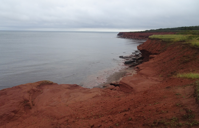
The color is due to an abundance of iron compounds in the sandstone.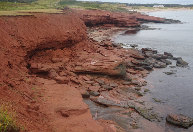
This is the photo of four of the Hopewell Rocks at low tide that I should be able to replicate at high tide tomorrow.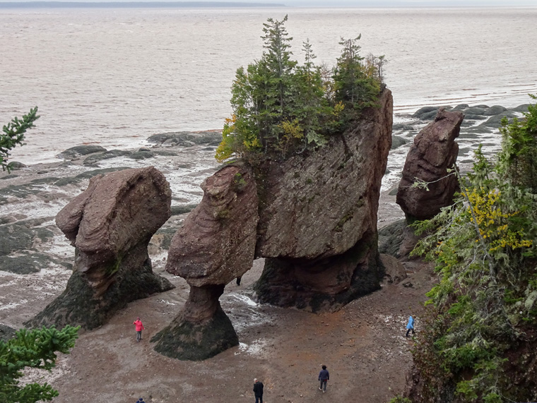
At low tide you are able to walk over a mile along the “ocean floor” and these are some of the more interesting rocks I saw. The first two have people in to give them scale.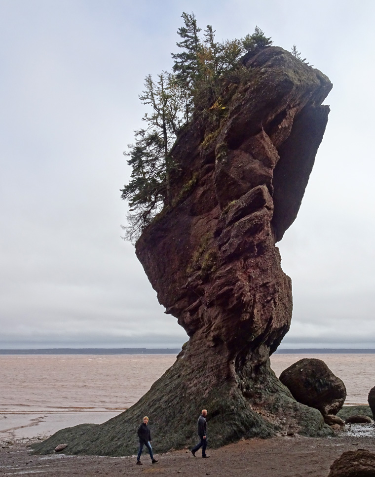
Hi Steve,
Your pictures look like my geography teacher used to show us in class!
Love the red sand and rocks.
You’re seeing some amazing things. Would never have dreamt of visiting these areas.
Cathy
Glad you enjoy them. I like that kind of stuff so I search it out. One problem with Hopewell Rocks, however, no decent beer available – first night with no local brew. Cheers, Steve.
These are the most spectacular pics yet. Keep them coming!
Thanks. I’m heading back to the States on Sunday and the weather does not look great for New England fall colors so that may be it.
Cheers, Steve.