Friday, Sep 30
Today was simply a driving day but it was along a route that I have been wanting to return to for several years, the Hells Canyon Scenic Byway. Hells Canyon was created by the Snake River and is the deepest river gorge in North America with the river some 7,993 feet below the highest part of the canyon rim. The river forms the boundary between Idaho and Oregon and the part of the scenic byway I drove was mainly along the Idaho river bank.
Starting from Ontario, Oregon I drove back into Idaho and then headed to the single road that runs alongside the river as it flows north to Hells Canyon Dam. The road is owned by Idaho Power and crosses all three hydro-electric dams built in the canyon as it zig-zags between Idaho and Oregon. The views of the river and canyon are spectacular and I stopped many times to enjoy the view and take photos on the way. I had visited the area in the early 2000s and my over-riding memory was not the view but the wonderful serenity of the place when no vehicles were passing. It seems to have a silence that is unique and I experienced the same feeling again today.
After reaching Hells Canyon Dam there is no option but to retrace your path southwards along the canyon and I then followed the scenic byway all the way to its end at Baker City, Oregon where I stopped for the night.
Since the route goes both directions along a single road and it was so scenic I decided to split the video into two parts.
The drive north, from Ontario to Hells Canyon Dam, is here. This has some very good views of the river and canyon and the video is very clear as the sun was behind me. However, the second part, Hells Canyon Dam to Baker City, has much better views of the river and, despite driving into the sun at times, gives a better taste of what is in store for any visitor. That map/video is here.
This is a view of the Snake River several miles before it even enters Hells Canyon
Looking downstream towards Hells Canyon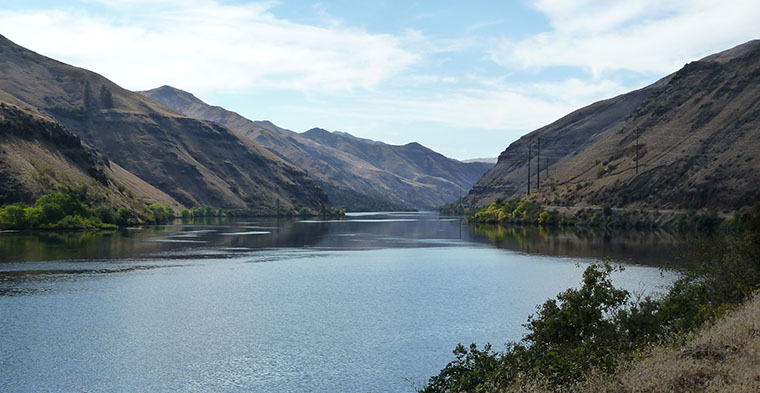
The serenity of the area is reflected in the surface of the water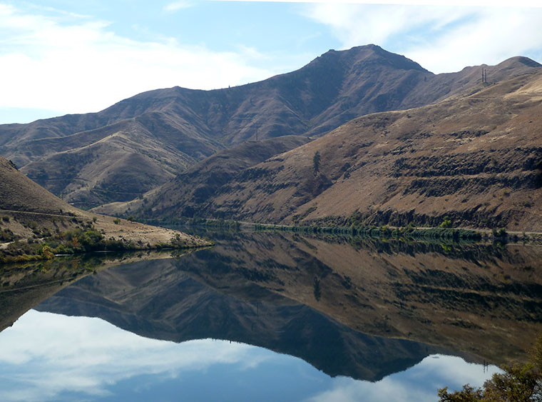
and a view of the river as it flows through Hells Canyon.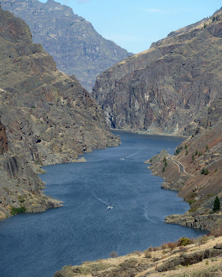
You’ve just connected my 2014 trip (furthest west – Craters of the Moon / EBR-1) and my 2004 trip (furthest east – the Oregon / Idaho border somewhere on today’s map). Nice to know that my US holidays (7 of them) can be joined up!
I’m jealous that you got to visit EBR-1 and it’s also comforting that my trips overlap yours to such an extent. As ex-physics teachers it shows a certain common perception of places worth visiting.